FURNACE FALLS
|
FURNACE FALLS |
|
|
|
|
NAME: Furnace Falls COUNTY: Haliburton ROADS: 4WD GRID: 1 CLIMATE: Snow in winter BEST TIME TO VISIT: All year |
COMMENTS:
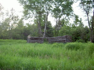
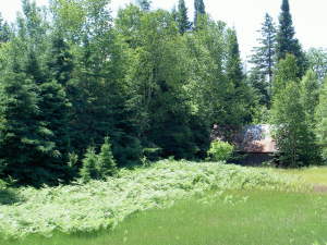
From Highway 503 take the exit to White Boundary Road. Continue on this road for 1.2 kilometers. The former town site is situated in an open field. REMAINS: Old log buildings |
|
Furnace Falls was first settled in 1874 to accomodate workers at the Snowdown Iron Mine (in Snowdon Township) at Lot 20 Concession 1. By 1887 a siding and flag station was built on the Irondale, Bancroft and Ottawa Railway (IB&OR) and was situated between the communities of Irondale and Howland Station where Furnace Falls sprang up at mile 4.9 on the railway line. (Eventually this line included stops at: Howland, Conways, Furnace Falls, Irondale, Maxwells, Gooderham, Hotspur, Tory Hill, Ward, Wilberforce, Ironsides, Harcourt, Highland Grove, Baptiste, Hughs and York River). The Snowdon Mine was located at mile 6.75 on the IB&OR rail line. J.C. Parry opened a saw and shingle mill at Lot 18 Concession 1 after iron ore was found here too. He also built a store in 1883 which served as the settlement’s post office. There was also a smelting works, workshops, 5 homes and other buildings in the hamlet. Later there was a Furnace Falls school called USS #7. After Parry’s run as postmaster ended, Jeremiah Herlihey took over from 1886 until he died in 1910. The village was already in decline by 1900 when the mine closed. By 1912 the Carr family took over the store until 1967 when it closed for good. The hamlet never had a population higher than 50. Today the only remains of Furnace Falls are the falls themeselves and sporadic log buildings and barns. You can find the former village in Haliburton County. From Highway 503 take the exit on White Boundary Road. Continue on this road for 1.2 kilometers to an open field with a log building on the north side. According to modern maps this is town centre, but is actually the southern section of the village. After extensive research I have located the actual northern section of the village on the former IB&OR railway line that is now a trail. To the south of the abandoned barn and log cabin visible from County Rd. 503 (just before the picnic area) there is a creek where the rail trail crosses. This is about where the flag stop was located for Furnace Falls. Another interesting tidbit I came across in my research is that the Monck Colonization Rd. that runs east-west through Kinmount continued east from there and stayed along the south side of the Irondale River. Today it crosses onto the north side of the river at the picnic area. Therefore, I must assume that the White Boundary Rd. where Furnace Falls is marked on modern maps was once the old Monck Rd. as it is the only road that stays on the southern side of the river and heads in an east-west direction in that area. The photo below of a home from 1827 is from another village called Furnace Falls. This eastern Ontario village also had an iron works in the early 1800's, and was renamed "Lyndhurst" in 1846. . Submitted by: Clayton Self |
|
|
|
.jpg)
.jpg)
.jpg)
.jpg)
.jpg)
.jpg)