MOUNT TRUMBULL
|
MOUNT TRUMBULL |
|
|
|
|
NAME: Mount Trumbull COUNTY: Mohave ROADS: 2WD LEGAL INFO: T35N, R3W CLIMATE: Snow possible in winter, hot in summer BEST TIME TO VISIT: When there's no snow or rain (slippery dirt roads) |
COMMENTS:
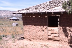
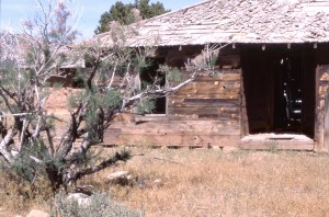
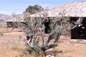
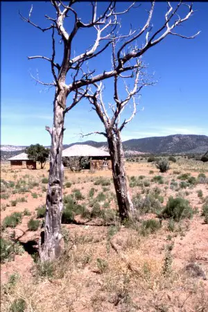
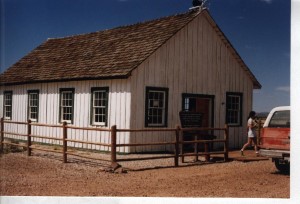
A few current residents. Use exit 8 off I-15 at St. George Utah. Head South on River Road to Ariz. state line. Take BLM Road 1069 South for around 18 miles to near Wolf Hole Lake. Pick up County Road #5 and take it for about 34 miles Southeast to the most notable feature in the town-- a restored white one-room schoolhouse. (Suggest you use BLM's Arizona Strip Map.). The exterior and part of the interior of the school house have been restored. The mountain for which the town was named is about 12 miles west over a narrow mountain dirt road. Mt. Trumbull itself is now a Wilderness Area.A 'must see' in the same area is Toroweep (Tuweep) overlook into the Grand Canyon. It is one of the narrowest parts of the Grand Canyon and offers a good view of the river. Vulcan's Throne and Lava Falls/Rapids are visible from Toroweep. There is a long, difficult trail down to the river from Vulcan's Throne. The overlook is about 65 miles from Fredonia, Ariz.To get to Toroweep, head east from the town and Mt. Trumbull Wilderness on County Road 5 and pick up BLM Road 115 South, about 20 miles to Tuweep Ranger Station and then the overlook. The last few miles to the overlook may be difficult for low-clearance vehicles. This is an isolated and very sparesely populated (but beautiful) area. There are no public facilities in the area. Take extra water and gas and stay on the main graded roads. REMAINS: Restored Schoolhouse, a number of scattered abandoned buildings and a few inhabited structures. |
|
Also known as "Bundyville" (after the towns leading family)The town was formed in 1916, and the current schoolhouse was built in 1922.The school was abandoned in the late 1960's. The area was originally settled by Mormon pioneers. Submitted by: Ray Kessler Although the most recent and complete 'biography' of the town (in the August 1996 issue of ARIZONA HIGHWAYS)says the town has "ceased to exist", this is not technically true: there are still some (more modern) homes located nearby. Moreover, the Bundyville school/church/townhall, which was 'torched' by vandals (cf. Tuweep) in July 2000, has been rebuilt by the descendents of the former residents and the current ones. The village had a post office from 1919 to 1950 (and is sometimes known as Mount Trumbull, near which it is located). Submitted by: Kurt Wenner Bundyville is in very remote area of the Arizona Strip; although the roads are well-graded, it is a long trip from any major town. |
|
|
|