MULE HOOF BEND
|
MULE HOOF BEND |
|
|
|
|
NAME: Mule Hoof Bend COUNTY: Gila ROADS: 2WD High clearance needed LEGAL INFO: T5N, R17E CLIMATE: Hot summer, cool winter BEST TIME TO VISIT: Anytime |
COMMENTS:
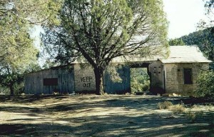
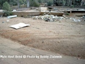
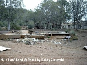
Remains of Mule Hoof Bend, Arizona are about 5 miles east of ghostown
Seneca on US 60 (just before Salt River Canyon in north direction). Take
FR 1302 (in San carlos Indian Reservation) when you reach Seneca. After
reservation and after Seneca Lake road change name to FR 473. Mule Hoof
Bend will came on the right side. I don't know much about history of
this place. My friend in Globe tell Me that wife shoot the husband in
the poker game, because he was cheating. After that the place became
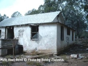
ghosttown. Posible to get there in 2 WD. REMAINS: A few abandoned buildings. |
|
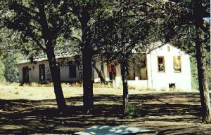
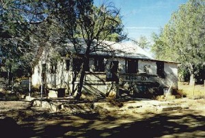
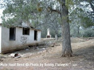
In the 50's this was an asbestos mine which still has abandoned sites all around it. At the main building lived Mr. and Mrs. Phillips who were the mine owners. They lived in the large house you photographed. The main mine was on a road from the main house down the wash into the canyon itself. The mine was built in the canyon wall and they had to use ropes to get down to the vein of asbestos. It was very dangerous until they dug into the mountain wall a ways and then were able to put 'guard rails' on the canyon face. Mr. Phillips appears to have been a 'rounder' for he apparently spent some time with ladies other than his wife. She shot him one night at the kitchen table with a magnum handgun by aiming the gun 'under the table' and hitting him 'between the legs'! Probably not a pretty sight. She was charged, found guilty but the jury understood her motive so her sentence was probably not to harsh. - Bobby Zlatevski and George Brunson. Some notes: From 'Seneca' (which was originally a small Indian encampment, then a small support town fore the mines in the area, then back to an Indian town built by the government then pretty much abandoned) you need to travel in a 'westerly' direction to Seneca Lake, go around the lake on it's north end to FS 473 as you noted. Then travel 'west' for about eight miles. Note about the area: Seneca proper, as well as the lake, is on the San Carlos Indian Reservation and as such one must cross reservation lines. Only need to exercise respect for the property and travel through only. To fish or camp at the lake one must have a 'permit' from San Carlos. After leaving the north end of the lake you are back on Forest Service land again. Noting the comments about the 'deteriation' and/or 'destruction' of the old towns in Gila County - The county is literally owned (controlled) by the US Forest Service (90+ %) and as such the Forest Service in it's early days tried to 'clean up' the forest and either removed buildings or burned them down. This is one of, and probably the largest reason, that the old mining towns and 'ghost' towns are no longer there. We do, however, still have numerous locations that have survived and are accessable in some way or another. Some, however, are a real challenge requiring four wheel drive, all terrain vehicle, horseback, or, walking! |
|
|
|