STOVEPIPE
|
STOVEPIPE |
|
|
|
|
NAME: Stovepipe COUNTY: Inyo ROADS: 2WD GRID #(see map): 3 CLIMATE: Desert. BEST TIME TO VISIT: Wintertime |
COMMENTS: 3
miles north of state route 190. REMAINS: Today the area has a service station, a cafe, a store, and a motel. |
|
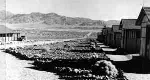
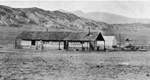
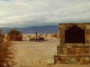
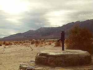
Stovepipe was named after a five foot length of pipe that was pushed into an important death Valley water hole. Some time early in the century a settler built a one room dugout by the well. Around 1906 when stages started crossing the area on the way to Skidoo Stovepipe became a stop. It had a canvas store, a tent lodging house, and a tent saloon. In 1926, a pioneer named Bob Eichbaum built 40 miles of road out to the area with the vision of it becoming a winter resort. After his death Inyo county purchased the road. In the 1940's, more wells were drilled. Today the area has a service station, a cafe, a store, and a motel. Courtesy Stanley Paher. 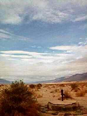 Original Stovepipe Well. View north. February 1997. Courtesy David A. Wright Great Basin Research 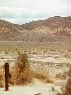 Original Stovepipe Well with the old Rhyolite to Skidoo auto and wagon road (faint line diagonally across photo away from camera) running east to rugged pass in Mud Hills in the background. February 1997. Courtesy David A. Wright Great Basin Research 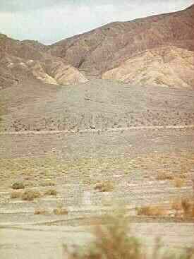 Rhyolite to Skidoo auto and wagon road at Stovepipe Well. View east toward Mud Hills. February 1997. Courtesy David A. Wright Great Basin Research |
|
|---|
|
|