|
ALBEMARLE |
|
|
|
|
NAME: Albemarle COUNTY: Sandoval ROADS: 2WD GRID #(see map): 2 CLIMATE: Snow in winter, cool in summer .BEST TIME TO VISIT:Summer, fall |
COMMENTS:
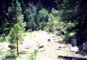
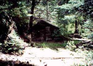
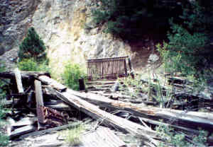
Located in Collie canyon, west
of Bland. Someone recently reopened the claim at the mine. Only
foundations left when I visited it in the late 80's. Served as
the party town for the miners at Bland. There is an old trestle
bridge still standing down the valley from the town site, by
hiking to it only. REMAINS: Some foundations and a few pieces of old stoves. |
|
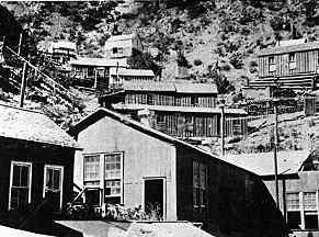
Active about the same time as Bland. Hillside had to be blasted out in order to build houses. Had a cyanide processor near the mine entrance. Submitted by Nick Nicolaus. Directions: From I-25 take the road to Cochiti Lake, which also goes by La Bajada, continue through town and on into Bland Canyon up towards the town of Bland ,which is on private property, and is gated and locked. One quarter of a mile before reaching Bland, turn left on the road leading to West Mesa and Collie Canyon. Upon getting to the top of West Mesa, you will see a metal gate, park there to begin your hike. The gate is locked, so you will need to crawl over the fence. Half way between the gate you just crossed and the one in front of you, you will come to an old road on the left that will lead you to Albemarle. About two miles down this road you will come to a trail on the right with two tall wooden posts, take this road down into Collie Canyon. If you listen carefully, perhaps you can still hear the mules skinner's cursing, because of the narrow steep road, two wagons could not meet. Once you get to the creek at the bottom, turn right and walk up the creek for about ¼ of a mile where you will once again pick up the road to Albemarle. Albemarle is about a ¼ of a mile past the cabin you will come on to. Some words of Caution: This area is very beautiful, but it is also very wild and very remote. I seen many signs of black bear and mountain lion. As a safety measure, be sure and tell someone where you will be and when you expect to return. The road leading from Bland Canyon to West Mesa is in terrible shape. With careful driving a 2WD vehicle can make to within a quarter of a mile from the top. Howevr, I would strongly recommend a 4WD which will get you all the way to the top. Going to Albemarle should be considered a day hike, so bring water and high energy food as it is about 10 miles RT. Bring rain gear, as it can rain anytime in the Jenez Mountains. If it should rain heavy, be prepared to spent the night in your vehicle, as the road back down to Bland Canyon may be to treacherous to drive on, even with a 4WD. On the top of West Mesa, either the road to the right or left provides for some wonderful camping. One could easily spend two days or more exploring this area. There are numerous mine shafts and caves in the area, and it should be remembered that these provide a cool place for black bears and mountain lions during hot weather. Submitted by Duane V. Peterson. |
|
|---|
|
|