WIDTSOE JUNCTION
|
WIDTSOE JUNCTION |
|
|
|
| NAME: Widtsoe
Junction COUNTY: Garfield ROADS: 2WD Grid #: 8 CLIMATE: Arid Desert. BEST TIME TO VISIT: Anytime |
COMMENTS:
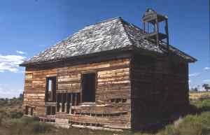
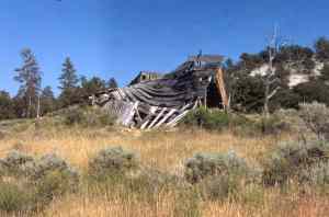
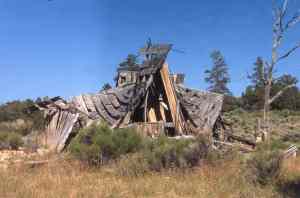
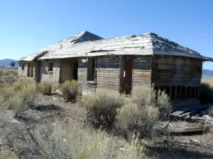
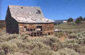
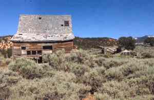
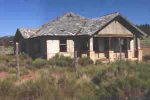
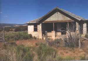
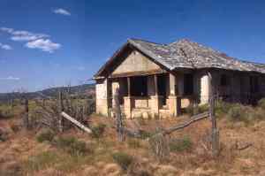
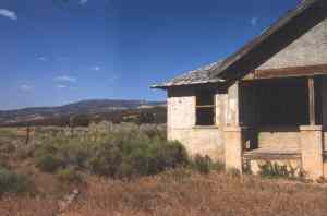
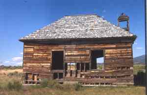
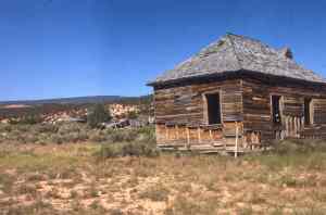
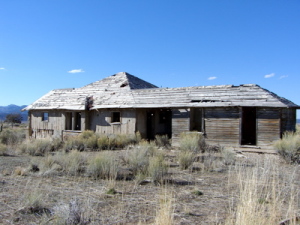
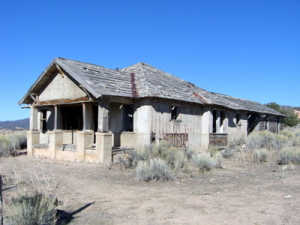
In John's Valley REMAINS: School building,private home and many cabins in different states of deterioration. Possibly a lumber mill stood on the site from the wood shaving remains. |
|
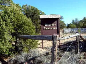
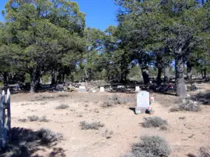
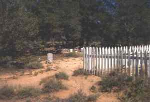
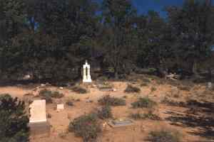
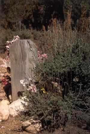
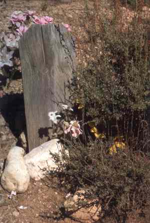
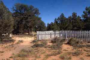
Settled by Mormons in the late 19th century; first had the name Adair after the most prominent family; as the settlement grew, the name was changed to Houston, and then in 1910, it was changed again to Winder--all of these were the names of prominent Mormons. In 1915, another settlement grew up about four miles north of Winder, by the name of Henderson (another prominent Mormon of the area); it got a post office, and grew for short period of time. However, by 1924, the post office in Henderson closed and most of the population moved to Winder. Then, in 1917, post office decided on its own for another name change (because there were too many 'Winder's: the new name was Widstoe, yet another prominent local LDS official. (Population in 1920 census was 1100). But the climatic and water problems of the valley were too much for that many people, and they began to move away. By 1935 the population was around 20; in 1936, the federal government bought the town--land, buildings, etc. At that point many of the buildings were torn down, but as of 1998, there were still (as I remember) around 3-5 houses, a prominent and large building which was probably the school, and some ruins (wood!) spread over a large area; probably at least one of these, the farthest one north along the road, is actually the last building left of Henderson, but I am not certain. Submitted by Kurt Wenner. The town is located on the East fork of the Sevier River, approximately sixteen miles northeast of Bryce Canyon. One of the first Euro-American settlers in the area was Isaac Riddle, who built a temporary ranch in the valley in 1876 which became a stop for the Hole-In-The-Rock pioneers in 1879. Jedediah Adair, along with one of his plural wives, Julia Ann, and eight children, eventually bought the land and moved onto the property in 1902. They practiced a new farming technique called dry farming. Other settlers moved into the area when they saw the Adair's success. In 1910, Julia Adair donated 40 of her acres for the beginnings of a town. It was established as "Winder" (named in honor of President John R. Winder [First Counselor in the First Presidency of the Church of Jesus Christ of Latter-Day Saints]). The standard of living was low with water having to be brought into town in barrels, fuel was wood from the surrounding hills, and coal oil lamps or candles lighted the homes. Running water, piped in iron pipes from a nearby spring, was brought to the town in 1915. On April 13, 1914, the town grew when it added another 160 acres (donated by Carel & Lottie Mangum and Quince K. Kimball). By this time, the town had two hotels, an LDS church, four stores, a post office, a confectionery, and a population of 310. The town had also built a new 3-room schoolhouse. In April, 1917, Winder changed its name to Widtsoe, in honor of LDS Church Apostle and dry farming expert John A. Widtsoe. In 1919, the Forest Service moved its district office, containing the first telephone, from Panguitch to Widtsoe. The 1920 census puts the population of Widtsoe at approximately 365 people (not 1,100 as you have listed) - this is taken directly from the 1920 census (copies of which are in my possession). The town reached it's heyday in the early 1920's. There was talk of moving the county seat from Panguitch to Widtsoe. In 1923, W. F. Holt, the financier-developer of Imperial Valley, California, was interested in investing capital in the area by Quince Kimball, by then a prominent State Senator. Holt (who also founded the nearby town of Osiris) bought the Widtsoe Hotel, built over ten homes, constructed dams and irrigation canals, provided funds for telephone lines, and brought in high-altitude lettuce seed (which was considered to be the best iceberg lettuce in the world). Holt spent nearly $300,000 in the area. Severe drought, erosion of the land, drastic climate fluctuations, and large numbers of rodents took their toll. People began to leave "the most destitute of any area in the state". By 1934, only 40 families remained in Widtsoe. By that spring, the residents' plight was critical. Two residents wrote a petition, which over 40 residents signed, requesting federal aid. Officials from the federal Resettlement Administration (RA) determined that the people should be moved out of the sub-marginal area since the land could no longer support them. The residents held a town meeting and, on February 8, 1935, voted, with no coercion by the officials, to accept the government's offer of resettlement. The government purchased 30,000 acres from the residents and resettled 29 families to other tracts throughout the state. They spent a total of $81,300 (not including "operating costs") on the Widtsoe Project, which was used as a model of resettlement for the Western States. The project received national recognition. Dorothea Lange, a well-known photographer hired by the RA, visited the town in 1936 to provide publicity photos for the project. Also, an article in "Nation's Business" discussed the Widtsoe Project. The final families to leave Widtsoe with federal assistance left in March 1938. The name of Widtsoe was taken off highway signs and maps. Today, only a few weathered buildings remain; including a barn, the original 1-room schoolhouse, the Woodard house with assay office extension, another private residence, a few sheds, and root cellars. There is also the debris from other buildings. A weathered and bullet-riddled "stop" sign still stands at the west end of main street. The Widtsoe Cemetery is still in use with the most recent additions being infant twins buried in 1999. One third of the town site is privately owned, another third is owned by the State of Utah, School and Institutional Trust Lands Administration, the final third (including all streets and the city park) is owned by the federal government. The town is a poignant reminder of a by-gone era and the ephemeralness of life, but if you visit, remember DO NOT remove ANYTHING from the site as that would be a violation of both federal and state law (and both the BLM and the SITLA vigorously prosecute any vandals/pothunters/trespassers). Data on this town was compiled by Kristine Curry, for the State of Utah, during January-February 1998 and February-March 1999.
|
|
|---|
|
|