RAUSCH GAP
|
RAUSCH GAP |
|
|
|
|
NAME: Rausch Gap COUNTY: Lebanon ROADS: 2WD GRID: 6 CLIMATE: Snowy and cold in winter BEST TIME TO VISIT: Spring through fall |
COMMENTS:
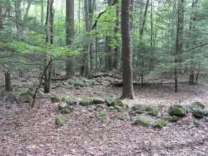
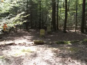
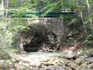
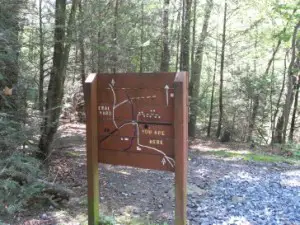
No current residents. Rausch Gap is accessible by the rail trail from Gold Mine Road at Gold Mine, travelling west three and a half miles. The Appalacian Trail crosses the rail trail at Rausch Gap and there's an Appalacian Trail shelter just up the mountainside from the old town site. REMAINS: In the upper town there are some cellar holes and foundations, foundations only in the lower town. There is a stone arch railroad bridge, now in disrepair, and there is an abandoned town cemetery with four remaining headstones, two of them legible. |
| Rausch gap was a setled town from 1828 until 1910, beginning as a coal mining town and a location of a railroad shop facility. At its height Rausch Gap had a population of 1000 people. The mining became unprofitable here as it did at other towns in Stony Creek Valley, and the railrod eventually pulled out. The rocky ground in Stony Creek Valley wasn't suitable for farming and when the railroad pulled out, the people left as well. Now the only remaining citizens are in the old cemetery down the Appalacian trail. Submitted by: David K. Schreur |
|
|
|