SALT FLAT
|
SALT FLAT |
|
|
|
|
NAME: Salt
Flat COUNTY: Hudspeth ROADS: 2WD GRID: 2 CLIMATE: Warm winter, hot summer BEST TIME TO VISIT:Winter, spring, fall |
COMMENTS:
Much to see. REMAINS: Mainly abandonded buildings. |
|
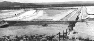
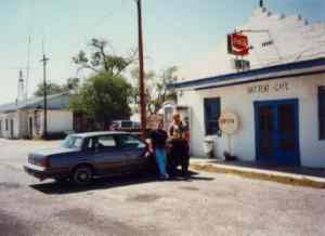
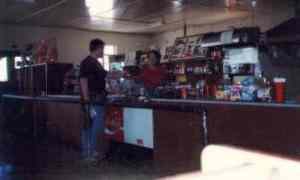
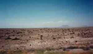
The maximum population at Salt Flat was fifty-four residents. Located in northeastern Hudspeth County on U.S. Highway 62/180 about 69 miles east of El Paso, Salt Flat served as a stopping place for travelers using the new highway that connected El Paso and Carlsbad, New Mexico that opened in 1929. The small community had several gas stations, cafes and a tourist court. The town takes its name from the natural salt flats that lie on the southwest side of the Guadalupe Mountains. The flat provided salt to inhabitants of the Rio Grande Valley for centuries and was hauled as far north as the Sacramento Mountains. Salt production ceased during the late 1930s. Salt Flat today is mostly a collection of abandoned and deteriorating buildings. SUBMITTED BY: Henry Chenoweth UPDATE:As of my visit in '96 the town consisted of about 5 buildings including a working Cafe and, apparently, a post office (visible in the second photo below, behind the telephone pole at the left). The cafe featured chili cheeseburgers (with chili peppers) and much-needed ice cream. The picture doesn't do the desolation of the place justice -- what you see in that photo is really *all* the place consists of, there are maybe 1-2 other buildings behind the cafe in that picture. The town is indeed along the highway from Carlsbad to El Paso. There were really no other buildings to be seen anywhere on that highway between those 2 cities, except for a gas station in "Dell Junction" where we found the gas pumps padlocked. Other towns listed on the map turned out nonexistant. - Peter Zurich |
|
|---|
|
|